Case Studies
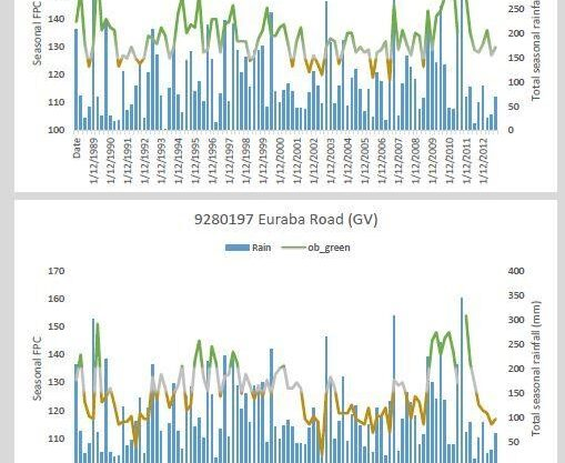
Groundwater-dependent Ecosystem Mapping using time-series Remote Sense Mapping
- Client: Queensland Government
- Location: Cape York Peninsula
- Area: 109,000km² (Timeseries analysis of 1988 – 2013)
- Sensors:
Landsat 5TM, 7ETM+, 8OLI; Bureau of Meteorology Rainfall timeseries; river gauge data; bathymetry.
The assessment identified locations of potential GDEs of various types (baseflow streams, wetlands, springs and terrestrial vegetation communities) present on Cape York. Used a combination of pre-existing information and remotely-sensed image analysis validated by field investigations. Mapping water-holding vegetation and open waterbodies were analysed together. New potential springs were identified in areas not previously investigated in the field or mapped.
Publications:
DSITIA 2014 Western Cape York groundwater study 2. Groundwater dependent ecosystems investigation supporting the assessment of groundwater sustainability in the Great Artesian Basin of Cape York. Department of Science, Information Technology, Innovation and the Arts, Brisbane.
Jonathan Marshall, Bill Senior, Cameron Schulz, Glenn McGregor, Leon Leach, Ged McMahon, Alisa Starkey (Ozius Spatial), Joanna Blessing Science Division │Department of Science, Information Technology, Innovation and the Arts

Time-Series Mine Rehabilitation Trajectory Analysis
- Client: Mining Client (Confidential)
- Location: Upland Swamps (2017)
- Sensors: DigitalGlobe’s Quickbird, Geoeye and Worldview-2 constellation; Airbus Defence and Space Pleiades constellation; Client supplied Lidar
Description:
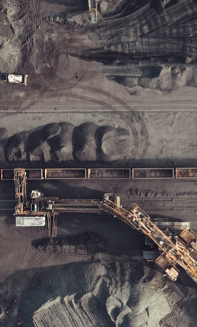
Ozius fused historical aerial photos, modern satellite imagery and piezometer data to determine groundwater connectivity of upland swamps and wetlands. Data suitable for integration with Hydrogeological models to inform rehabilitation costings and regulatory reporting. Ozius’s Vitality Index, combining fractional cover (density) and chlorophyll response and structural (height) metrics, were applied to enable swamp to swamp comparisons and quantify sub-swamp variability for optimising field efforts and on-ground management.

Groundwater-dependent Ecosystem (GDE), wetland and waterhole persistence mapping (2014-2016)
- Client: Department of Science, Information Technology and Innovation, Department of Natural Resources and Mines
- Location: Cape York Peninsula
- Sensors: Landsat 5TM, 7ETM+, 8OLI; Bureau of Meteorology Rainfall timeseries; river gauge data; bathymetry.
Description:
GDE and waterhole persistence mapping over Gulf of Carpentaria (Cape York, Flinders, Gilbert catchments), and northern Murray Darling Basin, QLD and NSW. Data to be suitable for release on Queensland Government’s Wetland Info online. Timeseries analysis of imagery for pre-field and post-field assessment of water resource assets based on regional Landsat imagery (1985-2015).
Our products have been assessed by the Queensland Herbarium and the Bureau of Meteorology and have been accepted as an improvement in the previous mapping of GDEs. The products have been integrated into the Queensland Herbarium GDE mapping products and the Bureau’s GDE Atlas and are be used by the Queensland Government to inform policy on a regional scale.

Remote Sensing of Floodplain Vegetation Across the Lower Balonne Floodplain – Murray Darling Basic Authority and Queensland Government
- Client: Queensland Government
- Area: 55,000km2 (Timeseries analysis of 1988 – 2015)
- Sensors: 5TM, 7ETM+, 8OLI; Bureau of Meteorology Rainfall timeseries; river gauge data; bathymetry.
Description:
Floodplain inundation mapping, Lower Balonne (QLD, NSW). Mapping water extent through time. Remote Sensing spatial analysis and mapping outputs relating to changes in vegetation distribution and condition in response to historical hydrological regimes (e.g. occurrences of river flooding and rainfall events). Linking imagery to climate and gauge data along with field site selection and in-situ field data collection such as groundwater bores, sap flow metres.
Publications:
Department of Science, Information Technology and Innovation and Department of Natural Resources and Mines 2017, Improving the understanding of water availability and use by vegetation of the Lower-Balonne Floodplain, The State of Queensland 2017. Click to view.
Using Remote Sensitive to Identify Refuge Waterholes to inform Sustainable Diversion Limits in the Northern Murray-Darling Basin
- Client: Queensland Government
- Area: 135,885km² (Timeseries analysis of 1988 – 2015)
- Sensors: Landsat 5TM, 7ETM+, 8OLI; Bureau of Meteorology Rainfall timeseries; river gauge data; bathymetry.
Description:
Mapping waterhole refuges after flow events in Lower Balonne, NSW and QLD. The purpose of this project is to map the distribution and characteristics of refugial waterholes, and to determine no-flow durations for environmental flows. It also investigated waterholes in the Barwon-Darling, to understand the permanence of refugial waterholes across the northern Basin.
Publications:
http://www.ffsaq.com.au/documents/RipRap_Edition39.pdf
https://www.ehp.qld.gov.au/water/policy/pdf/border-moonie-rivers-draft-hwmp.pdf
Marshall J.C, Menke N., Crook D.A, Lobegeiger J., Balcombe S., Huey J., Fawcett J., Bond N., Starkey A, Sternberg D, Linke S. and Arthington A.H. 2016. Go with the flow: the movement behaviour of fish from isolated waterhole refugia during connecting flow events in an intermittent dryland river. Freshwater Biology, 61, pp. 1242-1258.
Cousins K., Marshall J., Lobegeiger J., Bowlen J., Ng S., Foster N., Prior A., Starkey A., Thoms M., Reid M., Hofmann H, Larsen J., Sluggett A. 2015. Waterhole refuge mapping and analysis of persistence in the northern Murray-Darling Basin, Australia. Joint Conference for the New Zealand

Characterisation of waterhole persistence across the Northern Murray Darling Basin, Gulf of Carpentaria and Burdekin catchments
- Company: Queensland Government and Murray Darling Basin
- Area: 115,000km² (Timeseries analysis of 1988 – 2015)
- Sensors: Landsat 5TM, 7ETM+, 8OLI; Bureau of Meteorology Rainfall timeseries; river gauge data; bathymetry.
Description:
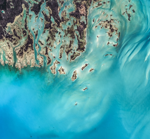
Waterhole extent and behaviour mapping and statistics (maximum, minimum and persistence mapping). This study investigated the persistence characteristics of waterholes (i.e. water habitat availability) by quantifying the surface area of wet pixels present in Landsat images representing a range of preceding no flow spell durations from 1988 – 2015. The project mapped the distribution of all waterholes in the Lower Balonne to Bourke, NSW, and provided information on the permanence of refugial waterholes across the northern Basin. This (above) is an example where waterholes were identified inside the known floodplain area (blue hatching) and outside to identify new habitats. This data was utilised to assess potential habitat of a protected Turtle species.

Knowledge in days, not weeks.
Gaining access to insight is critical to success in many industries. With advanced analytics from our Naxia platform delivered in record time, it’s easy to leverage our intelligence to power your next move.


